All Sights
The sights, landmarks, points of interest, entertainment and dining on the Costa Brava. Filter by type and location to quickly find places to visit on the Costa Brava coast.
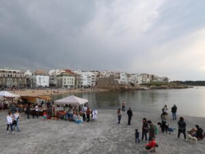
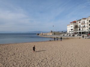
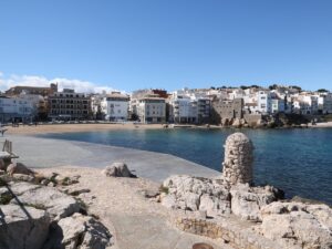
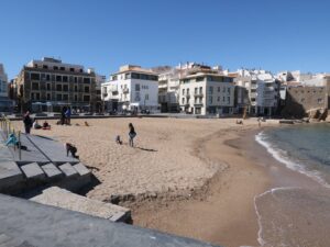
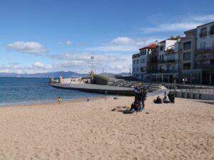
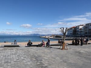
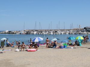
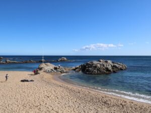
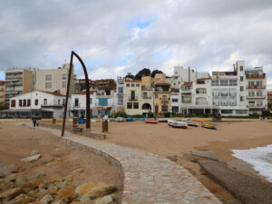
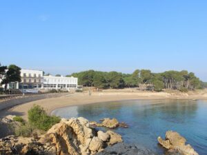
L’Escala is the only town in the Costa Brava whose sea promenade does not run along just one long beach, like, for instance, in Blanes or lloret de Mar. Instead, the beaches of L’Escala are a collection of coves and bays, from tiny to fairly large—Platja del Portitxol, Platja de Riells, Port d’en Perris, and Platja de les Barques (“The beach of the boats”).
The latter, despite its small size (100 m long and 20 m wide), is considered the main beach of L’Escala. When offering to meet “on the beach” for a stroll, lunch, some ice cream or a glass of wine, the locals mean the beach of Platja de les Barques.
This is where the key town events take place, including the procession for the holy patron of seamen on July 16 (Festa de la Mare de Déu del Carme), the Festival of Anchovies and Salt (Festa de la Sal), and the performances of the PortalBlau festival.
The Platja de les Barques beach, being the main one in a popular resort town, is well equipped (there are showers, washrooms, summer lifeguard service) and holds the Blue Flag designation for the quality and safety of its water.
Platja de les Barques
42.1266000000, 3.1332140000
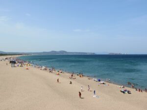
The main beach of Platja d’Aro, simply known as Platja Gran, stretches for more than two kilometres along the coast, which makes it the second largest beach on the Costa Brava, second only to the beach shared by Sant Antoni de Calonge and Palamós.
At first glance, its size is the only remarkable thing about Platja Gran. To discover its full potential one should walk along its entire length because the most exciting findings await you on either end of the long beach.
The southernmost point of Platja Gran is where the mouth of the river Ridaura is found, as well as the yacht club of Platja d’Aro, and the park Pineda de Riuet whose mighty pine trees offer welcome shade in the height of summer. The northernmost point is remarkable for Cavall Bernat, a phallic-shaped natural monument that gave the neighbouring promenade its name.


Platja Gran Beach of Platja d'Aro
41.8133450000, 3.0678420000

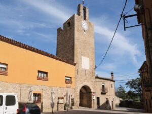
Directions: enter Plaça Port Bo, Calella de Palafrugell into your GPS.
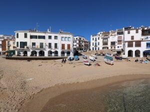
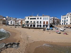
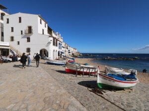
Port Bo
41.8882570000, 3.1851610000
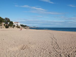
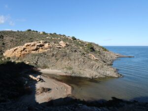
The cove Cala Port d’Esclanyà is found on Camí de Ronda halfway between the beach of Fornells and the beach of Aiguablava. The cove is named a “port” thanks to a small pier and boat storage lockers onsite. Before the pier was built, the cove was called Cala dels Tries.
This cove is uniquely suited to accommodate lovers of different beach types — here, you will find sand, pebbles and even smooth concrete on which to sunbathe and play.
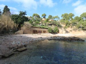
Port d'Esclanyà Bay
41.9361780000, 3.2142240000
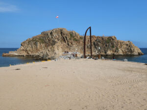
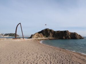
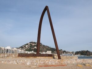
A rugged coastline, steep cliffs hiding cozy beaches, dense forests hanging above the sea are all distinct features of the Costa Brava, the principal Catalan coast. Sailing from Portugal to France, you would start seeing the typical Costa Brava landscapes right after leaving the port of Blanes behind. This spot is considered the southern portal to the Costa Brava.
This boundary exists unofficially, in conversations, books and guidebooks. Despite that, the Costa Brava brand is strong and has only gotten stronger in the last several decades, especially internationally, so the Blanes residents would likely consider it an insult if the public opinion suddenly shifted and the invisible border moved, say, more to the north.
Not that such a reverse would be possible after a monument shaped like an arch with a plaque “Portal de la Costa Brava” was installed on the city beach next to the rock Sa Palomera. The importance of this spot is reaffirmed every year during a whole week of fireworks shows in July—Sa Palomera is where the pyrotechnics participating in the international fireworks competition Focs de Blanes install their cannons to take part in the loudest and brightest summer event in the Costa Brava.
Portal to the Costa Brava
41.6708690000, 2.7909350000
The city beach of Portbou (Platja Gran de Portbou) is the northernmost beach on the Costa Brava coast that is fully equipped for the pleasure of its visitors: it has restaurants, bars, shops, showers, bathrooms and parking. The beach is long and narrow, measuring 270 m long and 15 m across, with dark grainy sand coverage. A small marina can be found to the right.
Despite the impressive list of amenities in Portbou, its beach enjoys moderate crowds even at the peak of the high season in July and August. Most of the tourists vacationing here are Catalans and their neighbours from France (the French-Spanish border is only a kilometre away from Portbou)—vacationers from other countries rarely venture north of Roses or Cadaqués, preferring to stay closer to Barcelona.


Portbou Beach
42.4271840000, 3.1609110000
Despite its wild and “brave” nature, Costa Brava is a well-inhabited coast with signs of human activity found even in its most remote corners. Even in the hardest-to-access coves requiring a multi-hour hike, you may find some sort of shed or shack standing modestly by the shore. For most of those sheds, their utility is self-evident, especially if there is a jetty nearby.
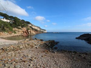
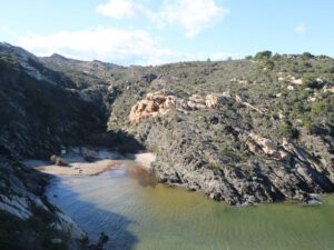
The little shack found in Cala Prona Cove, the farthest-removed cove in the natural reserve of Cap de Creus (Parc Natural de Cap de Creus), has a bit more history to it than usual. For starters, it dates back to the 18th century and what is more, it has at some point made it onto the privileged list of the objects of historical significance of Catalonia.
Cala Prona is unquestionably picturesque, but fishermen value its biodiversity, abundance of plankton and fish much more than its landscape aesthetics. For instance, it’s an ideal spot for tuna and mackerel fishing. To prevent crowding and overfishing, there has historically been a lottery held among fishers to assign fishing rights in the cove. The shack on the beach is used by all of them communally. (Maybe the door key is also hidden nearby?)
Visiting the Prona cove and capturing its beauty requires that you drive to El Port de la Selva and embark on a lengthy but unchallenging hike.
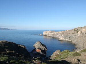
Prona Cove
42.3369300000, 3.2619900000