Archaeological sites
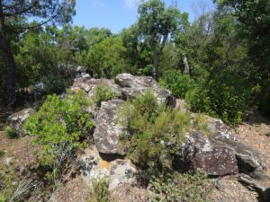
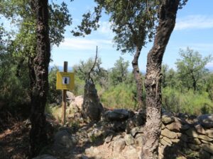
The existence of the dolmen Tres Caires (Dolmen dels Tres Caires) has been known since 1912. The archaeological group led by Catalan historian Lluís Esteva i Cruañas dug the megalith out in 1960s. The monument dates back to 3.000-2.500 B.C.; it’s one of the notable sights along the megalithic hiking route of Fitor.
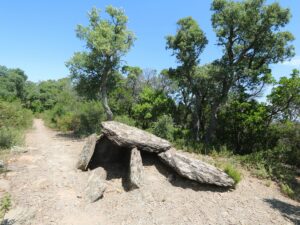
Dolmen of Tres Caires
41.9185870000, 3.0844000000
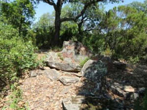
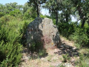
The dolmen Tres Peus (Dolmen dels Tres Peus), also known as The Big Rock (Pedra Gran), was first mentioned in a 1881 publication and was successfully retrieved from the ground in 1965. Archaeologists date it back to 3.200-3.000 B.C. The dolmen Tres Peus is a signature sight of the prehistoric hiking route in Fitor.
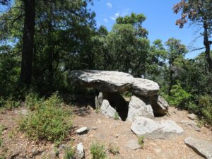
Dolmen of Tres Peus
41.9187550000, 3.0826320000
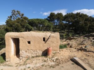
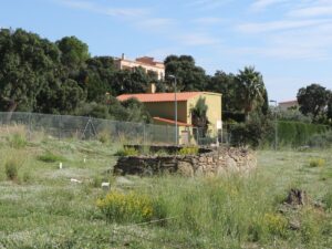
If you’d like to see some ancient Roman ruins or archaeological remains on the territory of modern-day Catalonia, you don’t necessarily need to travel to Barcelona or Tarragona to satisfy your fix — sometimes you may be casually riding a bike through a field and find a structure that was built in the 2nd-3rd century A.D. — literally in the middle of nowhere. A great example of the above is a funerary tower Torratxa de Vilablareix, found close to the parish church of the Vilabrareix village 5 km away from Girona.
The tower is made of two storeys of rectangular shape, approximately 3 by 4 meters each; the lower one had been used as the burial chamber. The tower is over 7 meters tall. Despite being looted over the centuries by treasure hunters and passersby, the structure has survived intact and has served as a shelter for many shepherds and travellers for longer than we will ever know.
The first studies of the tower date back to 1874. In 2002, it’s been established that the grounds around it are covering a Roman necropolis, so it is not outside of the realm of possibility to soon have the access to the tower restricted and the archaeological digging to begin. For now, the Vilablareix tower is absolutely free to visit.
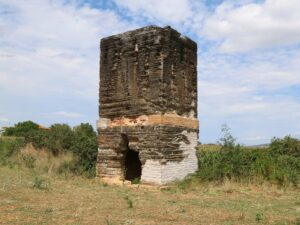
Funeral Tower of Vilablareix
41.9544200000, 2.7740100000

The burial grounds of Cista del Clot del Llorer date back to the period of 3500–3000 B.C. Its digging was carried out by the archaeological group of Lluís Esteva i Cruañas in 1965. The easiest way to see the burial is to follow the megalith route of Fitor.
Grave of Clot del Llorer
41.9221560000, 3.0764760000
Phone: 972 364 454
Opening hours: June-August Saturdays 5:00 pm to 7:00 pm
Iberian Village of Puig del Castellet
41.7160750000, 2.8482360000
Phone: 972 364 454
Opening hours:
October-May Saturdays, Sundays and holidays 10:00 am to 2:00 pm,
June-September every day 10:00 am to 1:00 pm and 5:00 pm to 7:00 pm
Closed on 1st and 6th January, 25th and 26th December


Iberian Village of Turó Rodó
41.6997800000, 2.8597770000
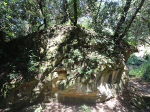
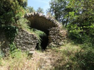
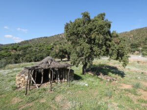
The ice well of the estate of Mas Cals, known as Pou de Glaç de Mas Cals, is one of the most ancient in the mountain range of Les Gavarres. Ice, together with coal and cork, used to form the list of the most important goods traded in the region. Faithful clients included the factories in Palamós that specialized in salting fish. Frozen water was crushed, lowered to the bottom of the well, pressed and covered by foliage, heather and straw. The Mas Cals ice well is must-see stop along the historical megalithic route of Fitor.
Ice Well of Mas Cals
41.9141480000, 3.0746480000
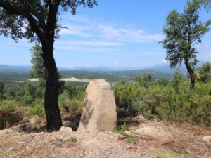
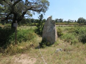
The menhir of Querafumat (Menhir del Querafumat) is one of the monuments of the megalithic era on the thematic hiking route around the village of Capmany that forms part of the Itinerànnia hiking network.
Menhir of Querafumat
42.3908920000, 2.9206230000
The menhir Pedra dreta Comanera I is a key point of the megalithic route of Capmany that forms part of the Itinerànnia hiking network.
Pedra dreta Comanera I Menhir
42.3766340000, 2.8987790000
The menhir Pedra dreta Comanera II is one of the rest stops along the megalithic route of Capmany that forms part of the Itinerànnia hiking network.
Pedra dreta Comanera II Menhir
42.3801740000, 2.8964470000
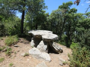
The dolmen Pedra Dreta de les Tres Finques was discovered in September 2011 by the land plot owner, and within a month, the archaeologists of Universitat Autònoma de Barcelona carried out excavations there. Scientists aren’t clear on the exact age of the monument. The dolmen Pedra Dreta de les Tres Finques stands on the megalithic route of Fitor.
Pedra Dreta de les Tres Finques Stone
41.9191890000, 3.0847510000
The menhir Quer Afumat I is one of the notable sights on the megalithic route around the village of Capmany that also belongs to Itinerànnia, a hiking route network.
Quer Afumat I Menhir
42.3939280000, 2.9116530000