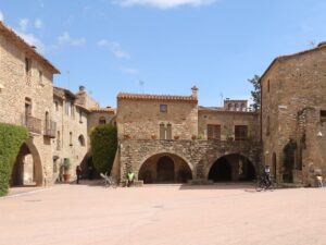
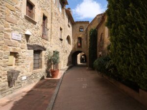
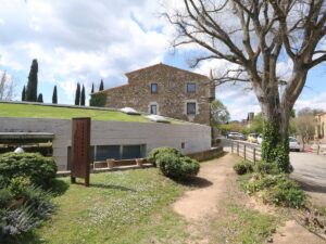
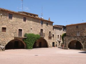
Interesting places
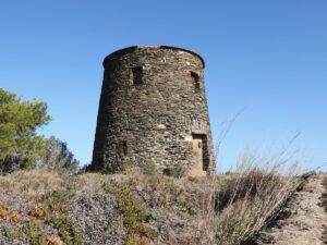
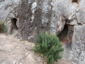
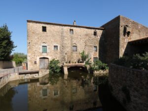
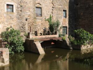
The Antique Public Laundry of Vilabertran
42.2816700000, 2.9771600000

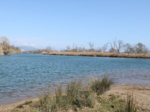
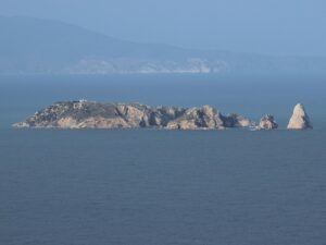
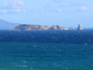
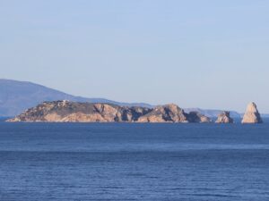
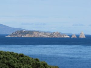
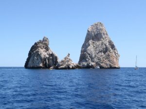
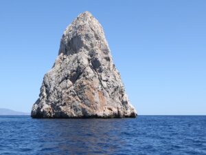
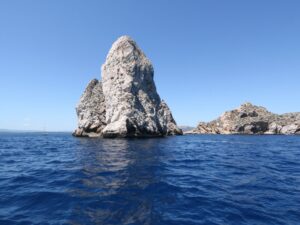
Les Illes Formigues (The Formigues Islands) is an archipelago in the Palamós and Calella de Palafrugell region of the Costa Brava that got its name thanks to its shape, size and the placement of all 16 islands that form it. The Formigues Islands are uninhabited, void of plant life, visited only by seagulls and cormorants keen to sunbathe on their shores less than 1 km away from the mainland. The only human presence is that of a lighthouse whose lights flash every 9 seconds, capable of reaching ships within the 6-nautical-miles radius.
Below the sea level, however, it is much livelier. Steep water depth differences (9 to 45 meters) and numerous underwater caves have played a part in the formation of a variety of biotopes (a land or a water area with uniform environmental conditions well suited for living organisms). The presence of biotopes drove the municipal government to unsuccessfully look for funding to transform the Formigues Islands into a natural reserve in 2011.
Throughout their long existence, the islands have witnessed many shipwrecks and even sea battles, one of which is written into the glory chapter of Catalonia’s history. It was here that on August 28, 1285, the 40-galley fleet under the command of Admiral Roger of Lauria sank 30 French and Genoese boats, disrupting the supply chain of the French army and altering the course of the war between the Crown of Aragon and France.
History is silent on the fact that much bloodshed, both literal and figurative, occurred for the control of the islands, possibly because of their small size — the archipelago occupies just over 0.3 hectares of land in total — and a highly advantageous strategical position. This is why the story of “the war” between the municipalities of Palamós and Palafrugell to call the islands theirs reads more like an anecdote than a fact.
The heated dispute between the towns had reached the High Tribunal of Spain. Each party had different reasons to litigate: one has fished around the island for centuries, while the other has had the islands as a backdrop since time immemorial… In the end, any verdict would have changed very little in the lives of locals and the tourists who come to enjoy the Costa Brava every season. The court ruled in favour of the 1717 agreement stipulating that one half of the archipelago belonged to Palamós and the other one to Palafrugell, ending the feud for good.
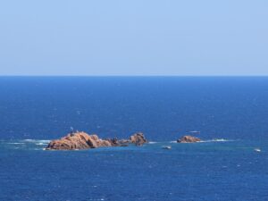
The Formigues Islands
41.8626450000, 3.1857840000
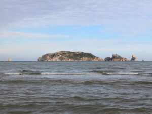
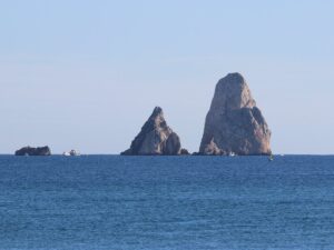
The Medes Islands (Illes Medes) is an archipelago of seven islands with the total area of 21.5 hectares. It is the main attraction of the L’Estartit resort towering over the sea a kilometre away from the beach. Not all islands of the archipelago are “real” islands — five out of seven are rocks sticking out of the water with no flat surfaces to step on or any plants to grow, but they still have names: Carall Bernat, Tascons Grossos, Tascons Petits, Medellot, Ferranelles. The other two are called Meda Gran and Meda Xica.
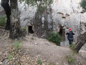
Since time immemorial the Medes islands have been a headache for the local villages. Since the archipelago is located so close to the shore, it provided easy cover for pirates and facilitated lightning-bolt attacks, all the while preventing the effective building of defensive structures. Martin the Humane founded a monastery on the islands in the 14th century, opining that the monks would defend it better, but there was no money to build a complete fortress. So in 1442, when the Genoese attacked the islands, all the meager fortifications that had been already erected were burned to the ground, along with the church. An unhurried restoration followed, interrupted in 1522 by a partial flooding of the western side of the island where all the fortifications stood.
In the 18th and 19th centuries, the Medes Islands played a role in armed conflicts between Spain and France. After the Napoleonic wars, a garrison had been stationed there, whose numbers had stably decreased over time until 1890, when the last soldier sailed to mainland leaving behind only a lighthouse keeper. Thanks to the lighthouse, there had been intelligent life on the Medes islands until the 1930s. After the technological advances allowed for the automation of the lighthouse operations, the keeper has gone too.
Biologists rave about the unique conditions for the flora and fauna of the Medes archipelago, mainly talking about the life underwater. A heterogeneous seabed in this marine zone has given rise to endless combinations of life-supporting factors of temperature, depth, light, currents speed, and soil composition. All of these combinations, in turn, created numerous unique biotopes that are home to so many sea creatures. Some examples you may encounter while diving in the Medes Islands: sea bream, sea bass, grouper, tuna, sea sponge colonies, red corals, meadows of Posidonia, mollusks of the noble pen shell and date shell, and so many more.
Since 1983, the government has adopted a whole host of measures and by-laws to protect the Medes archipelago from human influence, turning the islands into a conservation area where the only allowed activity is scuba or free diving. There are additional regulations in place: any diving session requires a license whose quantities are subject to an annual quota — 73000 for diving schools (there are about 20 in the area) and 4000 for independent divers. Up until 2015, the quota was daily and the number of dives hovered above 60000 a year, raising fears about their environmental impact.
These fears are not unfounded. The Medes Islands is one of the top diving spots in the Mediterranean that attracts divers of all levels with its diverse marine life, numerous sea caves and even a 120-metre long sunken ferry! Fishing around the islands has been prohibited since 1983, but fines and arrests are made from time to time regardless. The stats collected by the administration of the natural park of Montgrí (Parc Natural del Montgrí, les illes Medes i el Baix Ter), of which the Medes Islands have been a part of since 2010, tell the story of vanishing species and depleting fish numbers. Illegal fishing may be to blame: in September 2016 divers found an abandoned fishing net that was so long (200 meters!) that it took the firefighters two days to lift it from the sea bottom.
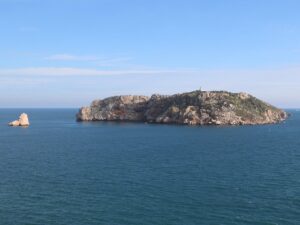
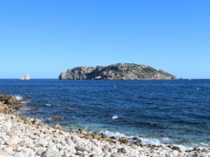
The Medes Islands
42.0479350000, 3.2216030000
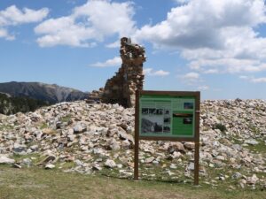
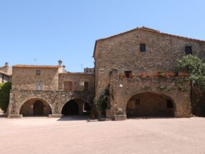
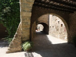
Count Ramon d’Empúries received authorization to build a castle in Gualta from King Jaume II in 1313 and, as evidenced by historical archives, the castle was already finished by the mid-14th century. A watchtower and fragments of the facade, easily recognized by their stonework colour, are all that’s left from the castle today.
The mill appeared here at the end of the Middle Ages; in the 17th century, it was reconstructed with an addition of a three-storey stone box with a bow arch at the entrance. According to a document dating back to 1725, the mill was owned by a count from Perelada and was used for rice and wheat milling.
At the beginning of the 20th century, the stream originating at the Daro river was tasked with producing electricity in addition to milling grain, making Molí de Gualta a champion in the variety of uses it had over the centuries. In the 1950s, the key historic sight of Gualta has finally retired for good.
Address: Carrer Major, 33 | 17257 Gualta, Girona
The Mill of Gualta
42.0276950000, 3.1040170000
The Canigou summit (Pica del Canigó) is the highest point of the Canigou mountain in the Pyrenees with the elevation of 2784 m, located in the French department of Pyrénées-Orientales. The Canigou is a sacred site for Catalan people where a large bonfire is lit on St. John’s Day to light all other bonfires in towns across the region. This annual tradition is known as La Flama del Canigó.
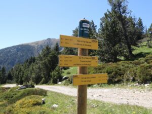
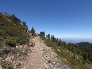
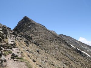
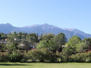

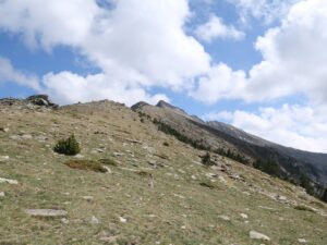
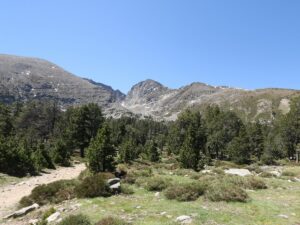
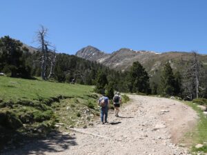
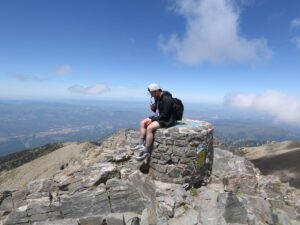
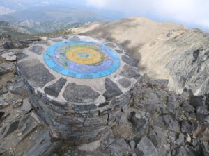
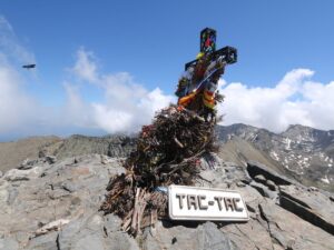
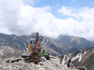
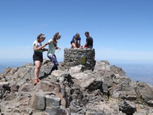
The Peak of Canigó
42.5188940000, 2.4566500000
The grand opening of the navigation and meteorology station Semáfor de Begur on the cape of Begur (Cap de Begur) took place on December 10, 1891. After the mayor of Begur Josep Font cut the red ribbon, the local elite moved to the local casino to continue the festivities.
The opening of a vital nautical navigation station was only one of the causes of celebration. The other, no less important, victory was the fact that Semáfor de Begur was snatched away from the neighbouring municipality of Palafrugell that proposed to house the new station on the same spot as the lighthouse Far de Sant Sebastià.
The station had served mariners until the 1970s. It is currently unused and closed to visitors, but there is a convenient lookout point right by its side with excellent views of the coast. You can reach the Begur Semaphore from the town centre along the streets Camí del Mar and Camí del Semáfor.
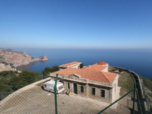
The Semaphore of Begur
41.9501630000, 3.2318190000