Castles
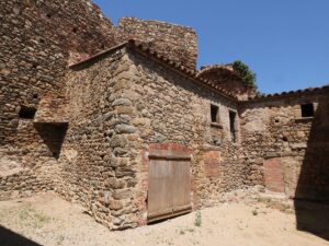
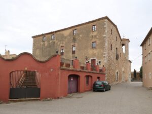
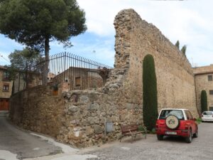
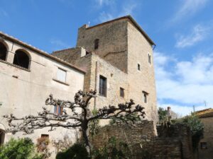
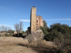
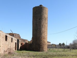
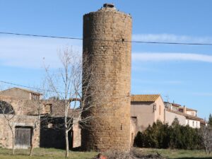
The estate and stronghold Can Borrull in the township of Santa Margarida in Palafrugell stands out from other structures of its kind by having two watchtowers instead of one and containing an integrated chapel, known as Santa Margarida or Sant Ponç de la Vilarnau. The chapel is significantly older than the house itself—it dates back to the 10th century, while the estate appeared in the township a whopping six centuries after.
The Borrull family had no land, no money and no power up until the 15th century when one of the family members distinguished himself during the Catalan Civil War of 1462-1472 by showing uncommon leadership and courage. He assembled a squad of volunteers to march to Girona, to the rescue of the crown prince Ferdinand and his mother Queen Juana Enríquez, trapped in the besieged Força Vella fortress. Upon becoming king, Ferdinand II of Aragon bestowed a military rank onto Borrull, laying the foundation of the family’s good fortunes. Soon after, the Borrulls controlled a significant part of the lands between Palafrugell and the coast.
Coordinates: 41.907360, 3.172205
Can Borrull Fortress
41.9073600000, 3.1722050000
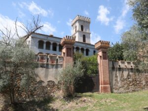
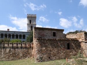

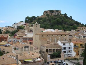
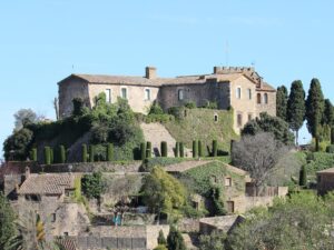
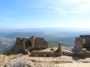
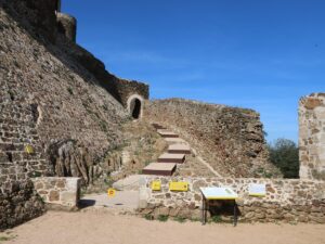
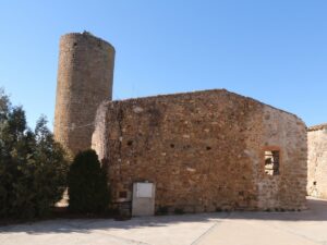
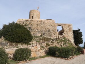
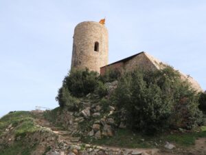
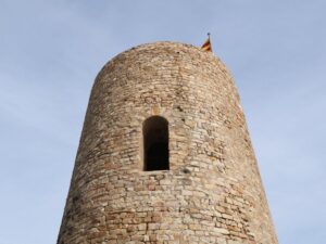
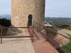
The main sight of Begur — the Begur castle, Castell de Begur — is perfectly visible from every observation point in town. It pops up here and there on photos and videos that often mean to capture completely different things!
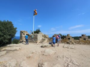
The castle was built in the 11th century by the feudal lord who wanted to protect his property from bloodthirsty pirates and jealous neighbours. Strategically speaking, the castle was ideally located to be easily defensible and thus, from that moment on, participated and suffered greatly in each armed conflict that befell the town, until it was destroyed completely in 1810 by the army of Napoleon Bonaparte.
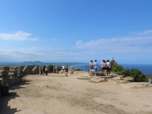
The extensive restorations of the 20th century only concerned the outer walls of the Begur castle, which was enough for the town to get its symbol back. Restoring the interiors was deemed unnecessary, as its most prized possession — the beautiful panoramic views of the mountains and the sea — couldn’t be taken away by even the most powerful enemy. Instead, the municipality outfitted the castle with a convenient observation deck for the visitors and tourists.
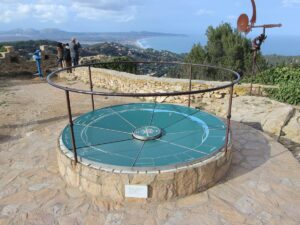
The visitors’ surprise and disappointment — where is the actual castle, pray tell? — quickly gives way to wonder and awe at the views. A circular ceramic map on a cylindrical pedestal introduces visitors to the local geography and helps pinpoint the beautiful elements of the landscape you see below: the islands Illes Medes, the Pyrenean peak El Canigó, the easternmost border of the Iberian peninsula Cap de Creus, the resort towns of the Costa Brava like Palamós and L’Estartit, the coves Sa Riera and Sa Tuna…
Castle of Begur (Castell de Begur)
41.9564400000, 3.2084670000
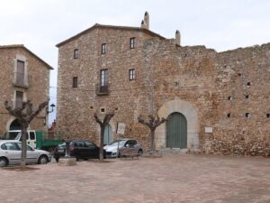
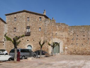
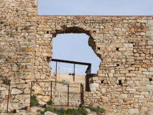
A dilapidated wall in the historic centre of Corçà is all that’s left from a 13th-century castle that first belonged to the episcopate of Girona and became the property of the Royal Court in 1442.
In 1475, the castle witnessed the most remarkable occurrence in its history—it was conquered by serfs in revolt. After three weeks of futile attempts to snuff out the uprising locally, an appeal to the higher power was made and, according to archives, the king sent two thousand men and artillery forces to assist in the subsequently successful liberation of the castle.
We must, however, call into question the claim of such significant reinforcement numbers. Even today, the population of Corçà barely exceeds a thousand habitants and it is hard to imagine the king being so intimidated by a fairly mundane incident to exercise such extravagance.
Castle of Corçà
41.9898440000, 3.0178260000
Opening hours: Please consult the website or call 972 011 960 for moe information.
Directions: The ascent to the castle begins at the point (41.781345, 2.536103). The hike takes 35-40 minutes.
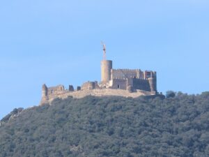
Castle of Montsoriu
41.7831910000, 2.5405580000
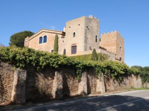
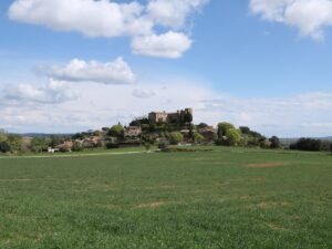
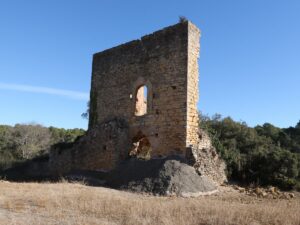
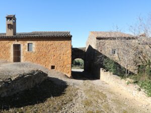
The Peralta castle (Castell de Peralta) was supposedly built in the 12-13th centuries, while the first mentions of it date back to the 14th century. Based on that, the local historians assume that the castle had originally belonged to feudal lords from Cruīïlles and Peratallada.
Nowadays, the castle has fallen into a state of disrepair — the Forallac municipality has been dragging its heels on restoration. The facade with a second-floor semicircular arch, a part of the main tower, an external staircase and bits and pieces of the fortification walls are all that remains from the original structure.
To visit the ruins of the castle of Peralta, take the highway C-66 towards La Bisbal d’Empordà and take the exit towards Santa Susanna de Peralta. Just before reaching the old parish church, to your right, you will see a grouping of stone houses with an arch portal. Beyond the portal lie the ruins of the Peralta castle.
Castle of Peralta
41.9547650000, 3.0912340000
Directions: Walk along Camí de Ronda for 2 minutes from La Fosca beach.
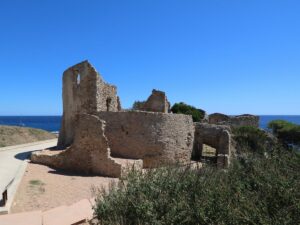
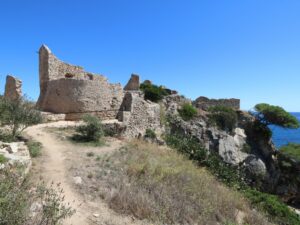
Castle of Sant Esteve de Mar
41.8582860000, 3.1476700000
Directions: The climb to the castle begins at the coordinates (41.679485, 2.798438) on Carrer Cardenal Vidal i Barraquer where the route GR® 92 (Stage 12) intersects with the street. The castle is one of the stops along the route.
Castle of Sant Joan de Blanes
41.6789840000, 2.7984280000