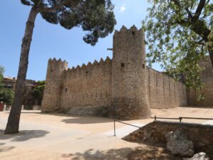
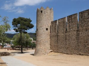
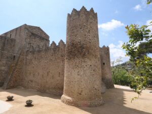
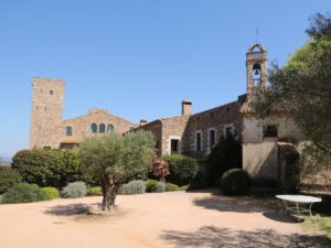
Castles
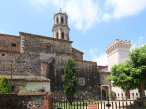
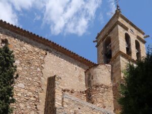
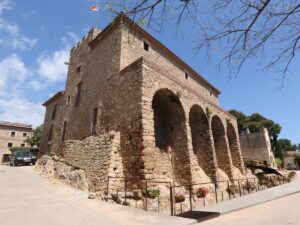
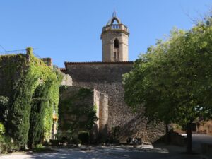
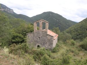
The first mention of the Castell d’Aro castle dates back to 1041. That year, Countess of Barcelona Ermessenda, her brother Bishop of Girona Pere Roger, and the head of the Pals family Gaufred Vidal all granted the safekeeping of the castle to the monastery of Sant Feliu de Guíxols.
The castle was first known as the Castle of Benedormiens, from bé (Catalan — good) and dorm (Catalan — sleep). In the 11th century, the village of Castell d’Aro was perhaps known as the place to get a good night’s sleep. Be that as it may, starting in the 12th century, the castle’s former name has been gradually forgotten in favour of the name of the village where it is located. “Castell d’Aro” is thought to have originated from the Pre-Roman word aro, “valley”.
The guardianship of the castle by the Catholic Church, a major landowner at the time, meant that it was regarded as a symbol of oppression by the local peasantry who paid land taxes to the Church. At least two instances of the castle’s destruction, occurring in 1344 and 1462, are associated with local serf revolts rather than war conflicts.
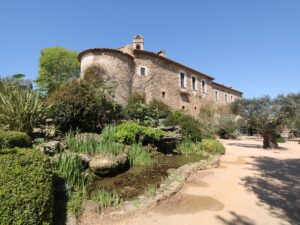
Between the 17th and the 18th centuries, the castle of Castell d’Aro was completely replanned and rebuilt, becoming a big fortified house in accordance with the building practices of the time. By the mid-20th century, the castle was a sorry sight, and only the interference of the locally engaged citizens prevented its demolition by the municipal government.
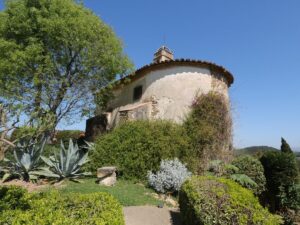
The renovations began in 1970 but came to a halt after the head planner Miquel Oliva’s death. The desire to wrap up the project with minimal effort and budget resulted in the loss of several typical Medieval design elements that the castle had, most notably its arched ceilings. Single pieces of the original structure have been preserved from the side that connects the castle to the church.
Today, the Castell d’Aro castle is municipally owned and serves as an art gallery and an exhibition space.
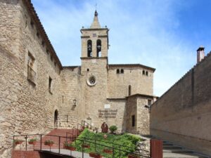
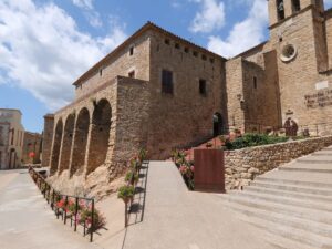
The Castle of Benedormiens
41.8151080000, 3.0307350000
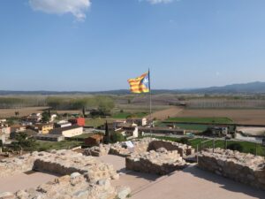
Castle coordinates: 42.295373, 3.194453
GI-614 parking coordinates: 42.295038, 3.205492
Coordinates for the route from GI-614 to the castle: 42.294024, 3.193155
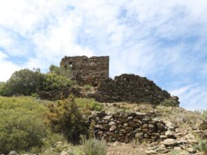
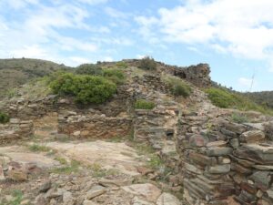
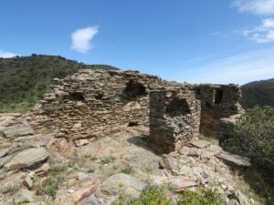
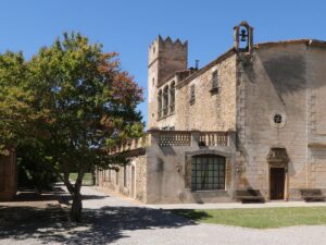
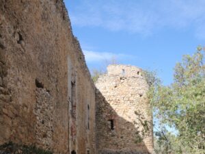
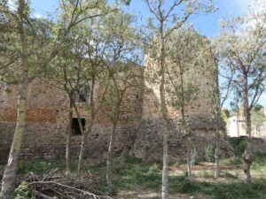
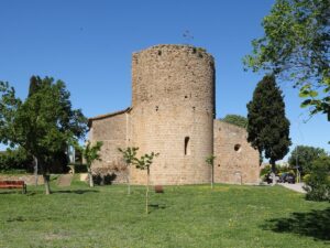
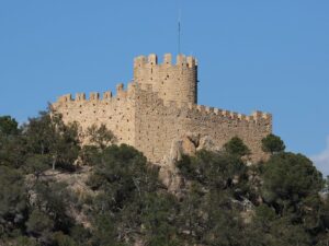
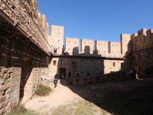
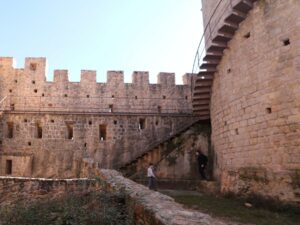
The Castle of Bufalaranya
42.2953730000, 3.1944530000

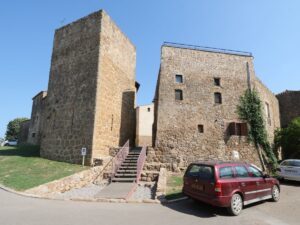
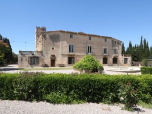
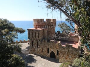
Castell d’en Plaja, a Neo-Gothic castle tucked to the side of the beach in Lloret de Mar, is a project of Catalan architect Isidre Bosch i Batallé who loved to work in the Art Nouveau style. Construction began in 1933 and was finished in the 1940s after the Civil War ended.
The castle was commissioned by Narcís Plaja Martí, a Girona entrepreneur with a clear vision for his summer residence. Locals who remember the Franco dictatorship era would also recall the last name “Plaja” by association with cookies Galetes Plaja. The factory making them is long defunct but the building housing it stands to this day at the intersection of Carrer Figuerola and Carrer Cerverí in the centre of Girona.
The castle Castell d’en Plaja is still owned by the Plaja family and is closed to the public so one can only admire it from afar, especially from the steps of Camí de Ronda.
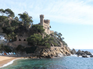
The Castle of Plaja
41.6993360000, 2.8595880000
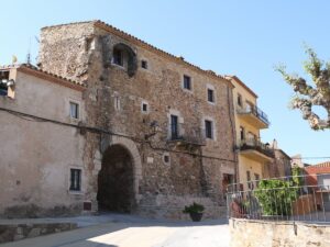
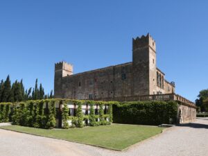
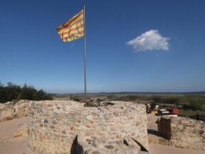
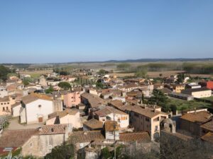
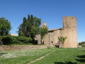
The first mention of the Farners castle (Castell de Farners) dates all the way back to the mid-9th century. Archived documents detail as follows: Ramon Berenguer the First, Count of Barcelona and Girona, hands over the building into the fiefdom of Viscount Ramon Folc of Cardona, while he, in his turn, dedicates the management of the property to another Ramon, this time Ramon Farners, as the representative of the family whose name now lives on both in the title of the castle and the town nearby (Santa Coloma de Farners).
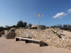
The fortress occupies about 200 square metres of the peak Turó del Vent in the vicinity of Santa Coloma. One watchtower inside the fortification walls especially stands out, measuring 12 metres tall, 8.40 metres in diameter, and with an entrance 7 metres above ground.
The Farners castle was built specifically for defence purposes but has seen very little warring action due to its location away from the key combat routes and therefore very low strategic combat value. Unlike many other fortresses that constantly changed hands over the centuries, Farners counts only a few instances of being controlled by strangers: in 1485 and 1489 local revolting peasants occupied it for a bit, plus at the beginning of the 18th century a French garrison was stationed here post-War of the Spanish Succession.
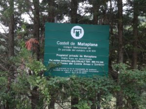
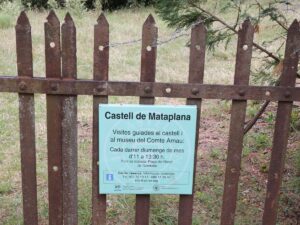
The Farners castle made the revered list of national cultural heritage objects in 1949. Visiting the castle is absolutely free.
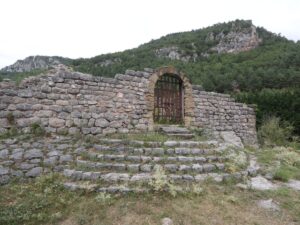
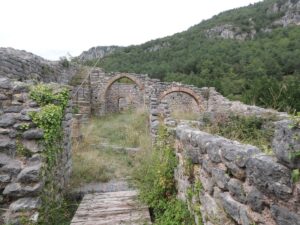
The Farners Castle
41.8603400000, 2.6310900000