Water sights
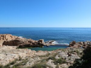
This swimming pool, located right by the sea between the beaches Platja de Fornells and Platja Fonda in Begur is marked as a local attraction on Google Maps, known to the world as Piscina natural Es Cau (the natural pool Es Cau). The water in it is definitely from the sea, but the way it gets in is not natural. Rather, it is replenished by a pump hidden in a small stone enclosure on the side. Calling it “natural” is a bit of a stretch, but the desire of passersby and tourists strolling along Camí de Ronda1 to take a dip is anything but!
Just as natural is the annoyance it causes the apartment owners nearby to whom the pool actually belongs—the seemingly brilliant idea to put smooth rocks on the shore to good use occurred to local residents about half a century ago. Today, explaining that the pool is, in fact, private property is a bit of a drag, and the problem is made worse by the fact that thousands of new people encounter the beautiful spot every day of the season.
Fencing it off isn’t an option due to the municipal law prohibiting any construction within 20 meters off the sea. The residents could disconnect the pump entirely, but thankfully it hasn’t yet come to that.
1)Camí de Ronda is a hiking route running between Blanes and Portbou along the Costa Brava coast.
Natural pool Es Cau
41.9399620000, 3.2175940000
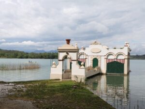
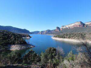
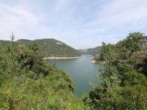
In 1962, several houses, a parish church and a bridge over the river Ter disappeared underwater practically overnight. The construction of the dam to splice the river in two was complete and a new blue splash appeared on the map of Catalonia, known today as the water reservoir Sau (Pantà de Sau).
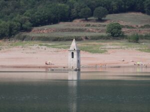
The first records of the village that was sacrificed for the dam, Sant Romà de Sau, date back to the 10th century. The church was consecrated in 1602. It has been described as built in the Romanesque style, with a nave with an apse and a three-storey belltower. The top floor windows of the belltower were shaped as half-arches. The decoration technique has been identified as Lombardian in origin.
Verifying these statements is only possible in especially draughty years when the water levels of the dam fall so low that it becomes possible to walk the streets of the drowned village. In seasons with average rainfall levels only one to two storeys of the belltower are visible above water.
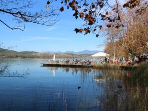
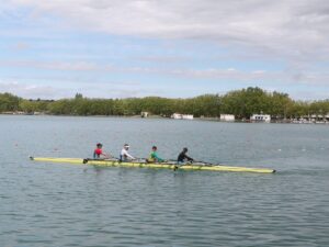
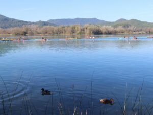
The Sau reservoir is 17 km long and 3 km wide—its maximum capacity is 151,3 hm3. It’s a popular weekend and vacation spot for lovers of water activities and sports.
Visitor information
Select Vilanova de Sau as the destination for your GPS and follow signs for Embassament de Sau or Pantà de Sau.
If the goal of your visit is to see the submerged church without diving, check the water levels prior to your visit at the official website of the Sau reservoir. The photos appearing here were taken in September 2016 when the levels were at 95 hm3. When they reach 120 hm3, only the very top of the belltower spire is visible.
Hotel Parador de Vic-Sau (4*), part of the national hotel association Paradores de Turismo, occupies an optimal vantage point on a nearby mountain, within hiking distance to the reservoir. The views from every window are fantastic.
Sau Reservoir
41.9680560000, 2.4130530000

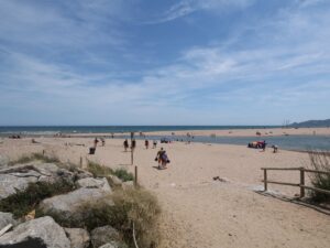
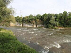
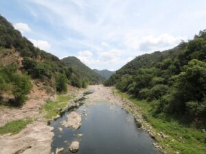
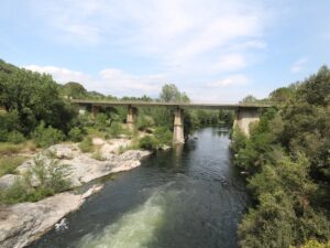
The river Ter rises in the icy Ulldeter in the Pyrenees at the elevation of 2,480 m and discharges into the Mediterranean Sea between the beaches of Pals and L’Estartit at the spot known as Gola del Ter.
The Ter runs for 208 km with an approximate drainage area of 3,010 m2 and an average flow rate of 17,15 cubic metres per second.
On its way to the sea, the river Ter is replenished by two major reservoirs, Pantà de Sau and Pantà de Susqueda, that also supply drinking water to many Catalan towns and cities, including Barcelona.
There is a hiking and cycling route that runs along the Ter, called Ruta del Ter, that makes an exciting multi-day trip (4-7 days).
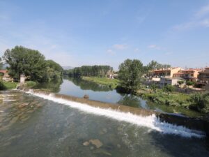
The River Ter
42.0235900000, 3.1886580000