Sights of L'Escala


Address: Carrer Camp dels Pilans, s/n, 17130 L’Escala, Girona
Phone: 972 77 47 27
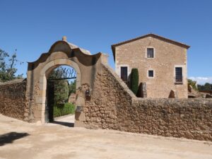
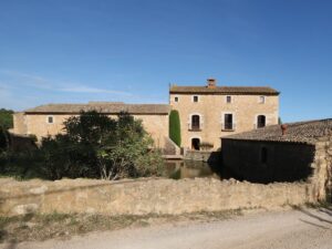
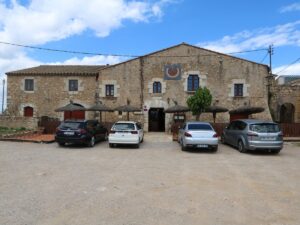
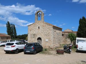
Restaurant Molí de l'Escala
42.1243700000, 3.1179830000
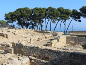
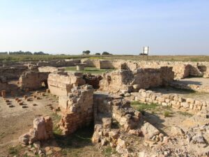
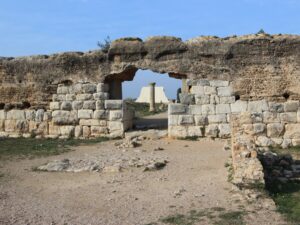
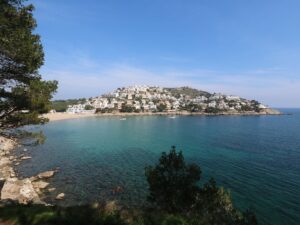
Local historians have known about the ancient Greek and Roman settlements around the Sant Martí village on the Mediterranean coast since the 15th century, but the archaeological digging has only begun here at the beginning of the 20th one. The works have been ongoing, interrupted only by the Civil War in the 1930s, with no end in sight. The part of the settlement that belonged to the Ancient Greeks has been more or less covered, while the newer and much bigger Roman one has barely been touched, with about one-fifth of the settlement studied so far.
An approximate timeline of events unfolding in the settlement since the 6th century B.C. has been put together as follows.
A peaceful party of the Phocaean Greeks landed here in 575 B.C. with plans to build a port to facilitate trade with the Phoenicians and the Indigetes (one of the Iberian peoples inhabiting Catalonia). The spot was chosen for its strategic location between the deltas of Rivers Ter and Fluvià. The port was named appropriately to reflect its commercial nature: Emporion (ἐμπόριον), from the Greek trading port.
Archives describe the settlement as an island fortress connected to the mainland by a narrow land strip. Today, one wouldn’t see anything remotely resembling an island — the changes in the landscape serve as a reminder of how long ago it was founded. However, in about 30 years after the settlement was first built, the question of expansion got put on the proverbial table: Emporion grew fast due to bustling trade but also because of the rising numbers of refugees fleeing the Persian-conquered Phocaea.
Following the expansion, the Old Town Palaiapolis (παλαιάπολις) got joined by the New Town, Neapolis (νεάπολις). The Neapolis is the old ruins we are able to visit today, while the Palaiapolis, never completely abandoned, is where the tiny village of Sant Martí d’Empúries stands today.
The 5th and 4th centuries B.C. were primetime of the Greek presence in Empúries, with the trade going great, the city growing and prospering. In the following hundred years, though, Emporion started getting outperformed by Carthage both economically and militarily. With the threat of war looming, the Greeks were forced to ask for the Roman help.
The first appearance of the Romans in Emporion dates back to 218 B.C., at the very beginning of the Second Punic War. In 195 B.C., a small Roman military camp sprung up next to the Greek colony, turning into a fully grown city in the matter of two centuries. The Romans, gradually assuming full power over Emporion by the mid-first century B.C., renamed the city Emporiae, but never threatened the Greek and the Indigetes local population that continued living there peacefully. However, the Roman population far outnumbered the native residents, and the latter got gradually absorbed into the Roman demographics by the first century A.D.
By the time the Romans established control over the Iberian Peninsula, Emporion had lost its influence — the trade and the population growth had shifted to Tarraco and Barcino (Tarragona and Barcelona of today), and people started to leave the city. The Neapolis was the first to be emptied, becoming a cemetery by the 4th century A.D., while the Roman part of the settlement remained inhabited until the Norman invasion of the 9th century. The Palaiapolis has survived through the centuries, adopting its modern name Empúries and even going through a Renaissance while serving as the capital of Ampurias County in the 9th-11th century.
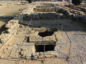
The list of the structures that have been uncovered by archaeologists onsite includes:
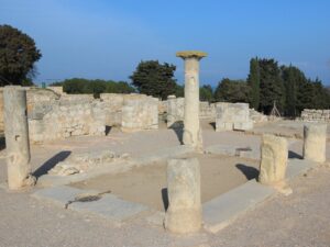
The Neapolis
1. fortification walls
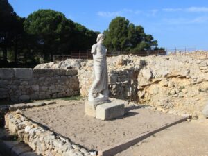
2. Asclepion, a group of three temples dedicated to the god of medicine Asclepius, that served as sacred places, but also as a hospital
3. a temple to Serapis, the god of abundance and fertility
4. agora, a market square also used for resident councils
5. stoa, a covered colonnade on the agora
6. a small marketplace around the water reservoir
7. classical Greek houses with peristyles and the later-period Roman houses with atriums
8. water filtration structures
9. a sewer system
10. a fish conservation factory
11. a metallurgy workshop
12. an early Christian basilica
13. a harbour mole 80 meters in length.
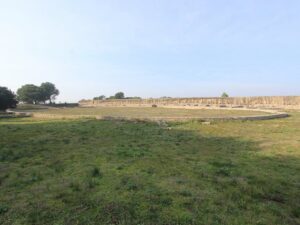
The Roman city
1. fortification walls
2. a Roman forum
3. a temple to Jupiter, Juno, and Minerva
4. a temple to Augustus
5. a basilica and a curia for courts and political gatherings
6. an amphitheatre
7. palaestra, a wrestling school
8. domus, houses of the wealthy families
9. Thermae.
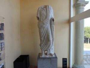
The most valuable and interesting objects found in the archaeological dig are showcased in the museum with rooms dedicated to both the Greek and the Roman cities. An excellently preserved statue of Asclepius is on show in a separate room — the statue you see in the Neapolis is its copy.
Visitor information
Address: Carrer Puig i Cadafalch, s/n | 17130 Empúries-l’Escala
Phone: +34 972 770 208
Opening hours:
01/06-30/09: daily from 10:00 am to 8:00 pm
01/10-15/11: daily from 10:00 am to 6:00 pm
16/11-15/02: from 10:00 am to 5:00 pm, except December 25, January 1 and Mondays
16/02-31/05: daily from 10:00 am to 6:00 pm
Holy Week: from 10:00 am to 7:00 pm
December 24, December 26 и December 31: from 10:00 am to 3:00 pm
Paid admission (5,50€) includes a visit to the ruins and the museum.
Arriving from Barcelona by car, follow the highway AP-7 towards L’Escala and then the signs for Ruïnes d’Empúries. By train, the closest railway station is Figueres.

Ruins of Empúries
42.1347510000, 3.1206540000

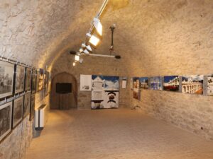
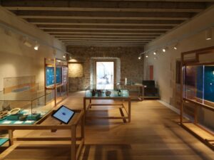
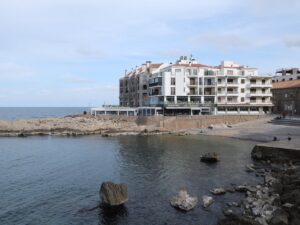
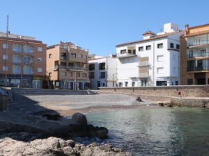
The Salt Warehouses (Alfolí de la Sal) in L’Escala were built in 1697 and, besides storing salt, also housed a customs office and a fishing association headquarters. By the decree of King Philip II, this location had a monopoly on storing salt in Empordà—from here, salt was transported to other villages and towns of the Costa Brava.
The Salt Warehouses today are a cultural centre with a small museum and an event space for exhibitions and concerts.
Phone number: 972 059 823
Opening hours (16th October – 14th March): Monday-Sunday 10:00 am to 1:00 pm, Friday-Saturday 5:00 pm to 8:00 pm.
Opening hours (15th March – 15th October): Monday-Satuday 10:00 am to 1:00 pm and 5:00 pm to 8:00 pm, Sundays 10:00 am to 1:00 pm.
Closed on 24th, 25th, 26th and 31st December, 1st and 6th January.
Salt Warehouses
42.1259050000, 3.1338550000
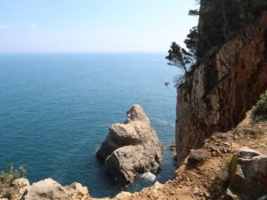
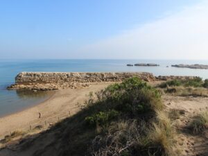
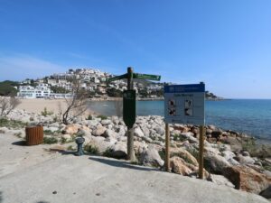
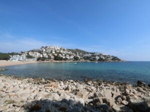
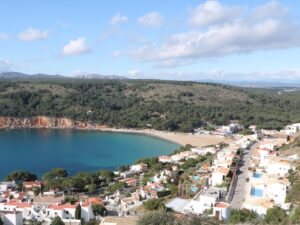
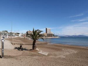
The cove of Montgó (Cala Montgó) stretches between two massive cliffs to the south of L’Escala. It is the only cove in the region fully covered from the cold winds of Tramuntana and is thus much beloved by weekend visitors in the off-season. The beach of Montgó is covered in fine white sand, a natural by-product of the hill erosion of the natural park of Montgrí.
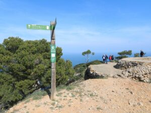
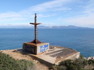
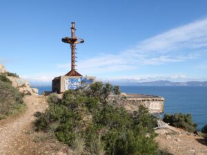
Cala Montgó is an excellent starting point for two short trips: to the northeast towards the Montgó tower and a Civil War bunker or to the southeast towards the capes Punta del Milà and Punta Ventosa.
The Montgó Bay
42.1077740000, 3.1691700000
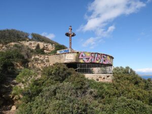
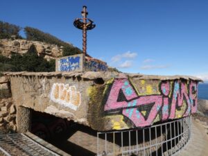
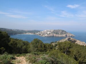
Torre d’en Montgó is an observation tower built in 1598 by the royal decree of Felipe I to protect the fishermen of L’Escala from pirates. The tower has been well preserved and is now included on the list of the national cultural heritage objects. Its prime location on a mountaintop that used to guarantee clear views of approaching enemy is still high in demand — the Montgó tower has an excellent scenic lookout with amazing vistas.
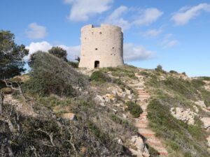
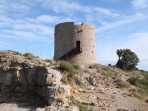
The Montgó Tower
42.1107770000, 3.1741470000
Address: Plaça Escoles, 1 | 17130 L’Escala
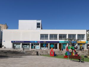
Tourism office of L'Escala
42.1225290000, 3.1312420000