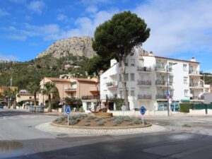
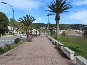
Sights of L'Estartit
Phone: 972 751 489
Boat Trips Agency Nautilus
42.0547940000, 3.2046800000
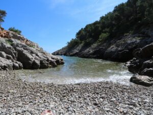
Directions: The cove is the end point for the SL®-C 20 route that begins in L’Estartit.
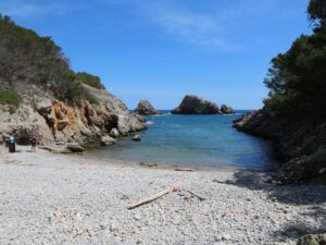
Ferriol Cove
42.0831890000, 3.1950750000

Phone: 972 751 472
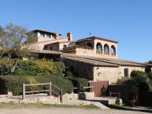
Horse Riding Club Mas Paguina
42.0398730000, 3.1838990000
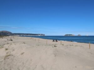
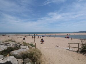
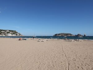
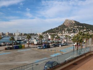
L’Estartit, formerly a modest fishing hamlet next to Torroella de Montgrí, is now a popular beach resort on the Costa Brava, far better known outside of Catalonia than even the municipal centre of the area. The town beach of L’Estartit is one of the largest on the coast, counting almost 1000 m in length.
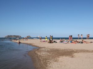
The beach of L’Estartit (Platja Gran de l’Estartit) is a dream come true for sunbathing with a view—less than a kilometre separates the shore from the Medes islands, one of the prime diving destinations not just in the region, but in the world.
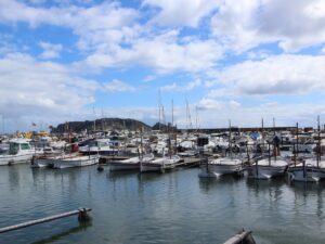
The beach has a dedicated lifeguard team, a diving school, and a water adventures agency. It is of course equipped with outdoor showers, parasol and lounger rentals, and a small port area from where boats and catamarans depart for the Medes islands, the cliff of La Foradada, and the pueblo of Sant Martí d’Empúries.
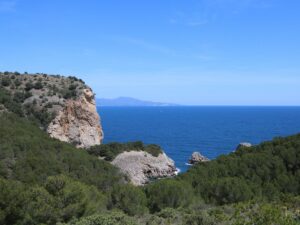
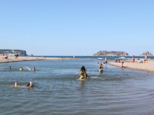
Walking south along the L’Estartit beach towards Pals and Begur, within half an hour you will reach a truly unique spot on the Costa Brava coast, La Gola del Ter, where the river Ter meets the Mediterranean sea. Here, you can alternate bathing in the sea with swimming in shallow river waters with a powerful current.
L'Estartit Beach
42.0479200000, 3.1985420000
Phone: 629 446 679, 650 458 312, 972 752 177
www.masdenbou.com
Mas d'en Bou
42.0369190000, 3.1823580000
Directions: The tower is one of the stops along the SL®-C 19 route that begins in L’Estartit.
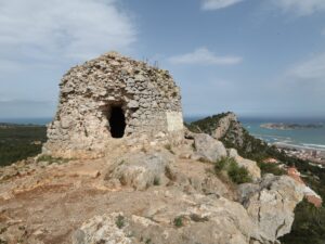
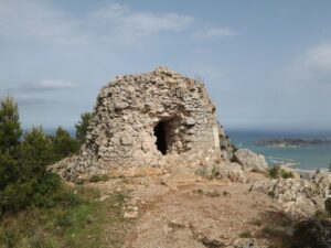
Moratxa Tower
42.0557080000, 3.1837370000

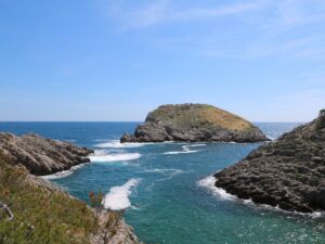
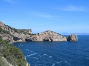
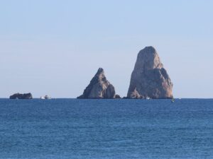
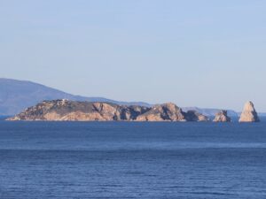
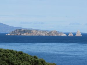
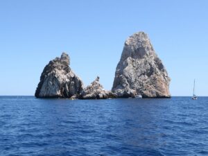
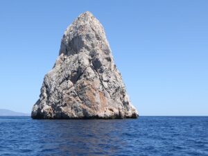
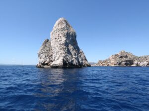
The Medes Islands (Illes Medes) is an archipelago of seven islands with the total area of 21.5 hectares. It is the main attraction of the L’Estartit resort towering over the sea a kilometre away from the beach. Not all islands of the archipelago are “real” islands — five out of seven are rocks sticking out of the water with no flat surfaces to step on or any plants to grow, but they still have names: Carall Bernat, Tascons Grossos, Tascons Petits, Medellot, Ferranelles. The other two are called Meda Gran and Meda Xica.
Since time immemorial the Medes islands have been a headache for the local villages. Since the archipelago is located so close to the shore, it provided easy cover for pirates and facilitated lightning-bolt attacks, all the while preventing the effective building of defensive structures. Martin the Humane founded a monastery on the islands in the 14th century, opining that the monks would defend it better, but there was no money to build a complete fortress. So in 1442, when the Genoese attacked the islands, all the meager fortifications that had been already erected were burned to the ground, along with the church. An unhurried restoration followed, interrupted in 1522 by a partial flooding of the western side of the island where all the fortifications stood.
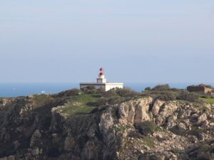
In the 18th and 19th centuries, the Medes Islands played a role in armed conflicts between Spain and France. After the Napoleonic wars, a garrison had been stationed there, whose numbers had stably decreased over time until 1890, when the last soldier sailed to mainland leaving behind only a lighthouse keeper. Thanks to the lighthouse, there had been intelligent life on the Medes islands until the 1930s. After the technological advances allowed for the automation of the lighthouse operations, the keeper has gone too.
Biologists rave about the unique conditions for the flora and fauna of the Medes archipelago, mainly talking about the life underwater. A heterogeneous seabed in this marine zone has given rise to endless combinations of life-supporting factors of temperature, depth, light, currents speed, and soil composition. All of these combinations, in turn, created numerous unique biotopes that are home to so many sea creatures. Some examples you may encounter while diving in the Medes Islands: sea bream, sea bass, grouper, tuna, sea sponge colonies, red corals, meadows of Posidonia, mollusks of the noble pen shell and date shell, and so many more.
Since 1983, the government has adopted a whole host of measures and by-laws to protect the Medes archipelago from human influence, turning the islands into a conservation area where the only allowed activity is scuba or free diving. There are additional regulations in place: any diving session requires a license whose quantities are subject to an annual quota — 73000 for diving schools (there are about 20 in the area) and 4000 for independent divers. Up until 2015, the quota was daily and the number of dives hovered above 60000 a year, raising fears about their environmental impact.
These fears are not unfounded. The Medes Islands is one of the top diving spots in the Mediterranean that attracts divers of all levels with its diverse marine life, numerous sea caves and even a 120-metre long sunken ferry! Fishing around the islands has been prohibited since 1983, but fines and arrests are made from time to time regardless. The stats collected by the administration of the natural park of Montgrí (Parc Natural del Montgrí, les illes Medes i el Baix Ter), of which the Medes Islands have been a part of since 2010, tell the story of vanishing species and depleting fish numbers. Illegal fishing may be to blame: in September 2016 divers found an abandoned fishing net that was so long (200 meters!) that it took the firefighters two days to lift it from the sea bottom.
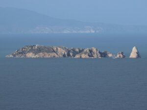
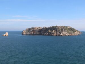
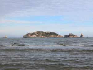
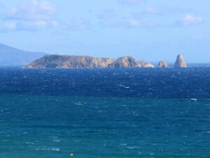
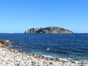
The Medes Islands
42.0479350000, 3.2216030000